Accommodation & Bookings - Getting here
View Larger Map
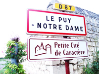
Le Puy Notre Dame is a village just south of the River Loire, in the department of Maine-et-Loire of the Pays de la Loire region of western France. It is situated 23 kilometres (15 miles) south west of Saumur and 54 kilometres (34 miles) south east of Angers both of which have rail links to Paris and beyond. It is just over a 1 hour drive from Tours and Poitiers airports which have flights to the UK. It is about a 3 hour drive from the nearest Channel ports of St Malo and Caen/Ouistreham and less than a 6 hour drive from the Eurotunnel and Calais.
You will find Le Clos de la Rose situated on the western edge of the village at
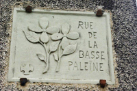
7 rue de la Basse Paleine,
Le Puy Notre Dame,
49260,
FRANCE.
Co-ordinates: Latitude 47.1265, Longitude:-0.239114
Co-ordinates: Latitude: 47° 7' 31'' North Longitude: 0° 13' 60'' West
Directions from Paris: take A11 then A85, take Saumur exit direction Poitiers (N147) and then D960 towards Doue-la-Fontaine and then take D87 to Le Puy Notre Dame
Directions from Angers: take N748/D761 direction Brissac/ Poitiers at Doué la Fontaine, take D87 to Le Puy Notre Dame.
Travel Links
www.eurostar.com/home/
www.brittany-ferries.co.uk/
www.ldlines.co.uk/
www.poferries.com/
www.norfolkline.com/ferry/
www.voyages-sncf.com/billet-train?_AGENCY=VSC
We are happy to offer our guests 10% discount off the cost of the ferry crossing (but not the cabins) if they book with Brittany Ferries.
Please Contact us for more details and if you would like us to give you tailor made directions.